
This year I've decided to break down the maps into a number of categories, so my Christmas listicles this year will be the listicles that just keep giving. To start off here are the 10 Funniest Maps of the Year.
For this category I've selected the maps that have given me the most fun. If you disagree with my choice don't be afraid to use the comments to tell me where I've gone wrong.
1. The Vaguely Rude Map

From Fucking in Austria to the Bald Knob in Arkansas the world is full of some surprisingly rude place names. The Vaguely Rude Map is a faithful compendium and atlas of rude place names around the world.
2. The Autocomplete Map

The USA and Saudi Arabia are evil, the UK is finished and of course Greece is the word. If you want to know what the English speaking world thinks of your country just use Google or Yahoo and autocomplete will do its best to tell you. The Autocomplete Map is a Google Map of sometimes funny and sometimes insulting Google autocomplete suggestions for countries, states and cities around the world.
3. Yarr, Pirate Maps

Ahoy mateys, Yarr, Pirate Maps is one damned clever map. Yarr, Pirate Maps is a Google Map but it uses a few clever tricks to create a distinct pirate themed design, complete with animated waves, birds and pirate ships.
4. NukeMap3D

Alex Wellerstein's NukeMap has proved to be a very popular Google Maps mashup. The application allows users to view the likely effect of different sized nuclear explosions on any location in the world, using Google Maps.
Much of its popularity comes from the fun of blowing places up on a map. I mean what could be more fun than that? Blowing things up in 3d - that's what. Alex Wellerstein's new app, NukeMap3D lets you do just that.
5. Superfreedraw

Superfreedraw uses Leaflet to provide a blank map, on which anyone is free to draw a big penis or write 'Yo Momma'.
Some of the user contributions might not be very clever but this is a very clever use of Leaflet. I also like the fact that Superfreedraw publish the map tile data once a month. I'm not sure why anyone would want these user contributed drawings as a map tile set but it is a nice touch.
6. Graffit Map

Why draw on a map though when you can draw on Street View? Graffit Map is a fun Street View application that allows you to add graffiti to Google's panoramic imagery.
The app allows you to select any location where Street View is available and draw directly on top of the Street View image. Users can select the brush size and color of their spray can and then start adding their tags to the world.
7. Can You Spot the Northampton Clown?

This year UsvsTh3m created a number of fun Street View games. One game was designed to scare the living bejesus out of unfortunate Coulrophobia sufferers. Can You Spot the Northampton Clown? requires you to take to the streets of an English town on Google Maps Street View and track down a clown who is terrorizing the local inhabitants.
8. Map of the Dead
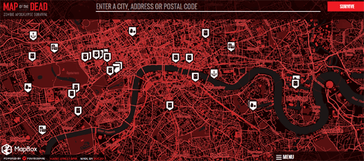
Just in case the zombie apocalypse starts tonight you might want to bookmark the Map of the Dead.
Just enter your address into Map the Dead and you are presented with a handy map displaying the zombie danger zones around your home. The map also displays nearby places that are likely to have resources to help you survive once the zombies begin to take control.
It is highly likely that the internet will not survive the rise of the dead so you are advised to print out your personalized Map of the Dead and store it in a secure location.
9. Weird British Road Names

The Vaguely Rude Places map obviously titillated more than a few people around the world. However not everyone has such a puerile sense of humour. Therefore if you are irritated by 'Sandy Balls' you might prefer instead to visit the Weird British Road Names map.
Weird British Road Names is a collection of some of the strangest monikers to be given to UK streets and roads. Some of them are truly strange, some are rude, whilst others are simply wonderful. After all who wouldn't want to live in a road called the Land of Green Ginger.
10. Metropho.rs

Metropho.rs is a map of the world where each country has been renamed based on metaphors used in Twitter - where one country has been described as being like another country or geographical location.
For example, according to Collin Jo,
"Africa is the Cleveland, Ohio of the entire planet". Therefore on
Metropho.rs Africa has been renamed Cleveland. You can click on the map labels to read the original Twitter country
comparison.
No comments:
Post a Comment